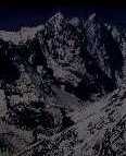
Mt. Everest
the top of the world
more detail...
|
LAND:
The Tarai forms the northern extension of the Gangetic Plain and varies in width from less
than 16 to more than 20 miles, narrowing considerably in several places. A 10-mile-wide
belt of rich agricultural land stretches along the southern part of the Tarai; the northern
section, adjoining the foothills, is a marshy region in which wild animals dwell.
The Churia Range, which is sparsely populated, rises in almost perpendicular escarpments to an altitude of more
than 4,000 feet. Between the Churia Range to the south and the Mahabharat Range to the north, there are broad
basins from 2,000 to 3,000 feet high, about 10 miles wide, and 20 to 40 miles long; these basins are often
referred to as the Inner Tarai. In many places they have been cleared of the forests and savanna grass to provide
timber and areas for cultivation.
A complex system of mountain ranges in elevation from 8,000 to 14,000 feet, lie between the Mahabharat Range
and the Great Himalayas. To the north of the Mahabharat Range, which encloses the valley of Kathmandu, are
the ranges of the Inner Himalaya (Lesser Himalaya), rising to perpetually snow-covered peaks. The Kathmandu
and the Pokhara valleys lying within this mid-mountain region are flat basins.
The Great Himalaya Range, ranging in elevation from 14,000 to more than 29,000 feet, contains many of the
world's highest peaks--Everest, Kanchenjunga I, Lhotse I, Makalu I, Cho Oyu, Dhaulagiri I, Manaslu I, and
Annapurna I--all of them above 26,400 feet. Except for scattered settlements in high mountain valleys, this entire
area is uninhabited.
 PREVIOUS PAGE (location) |
NEXT PAGE (climate) PREVIOUS PAGE (location) |
NEXT PAGE (climate) 
|
